General Context
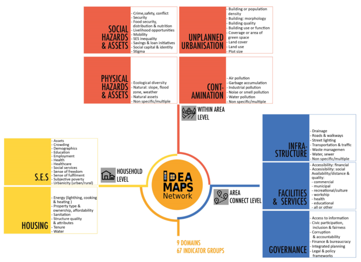
The UN estimates that around 90% of population growth over the next 30 years will happen in African and Asian cities. This rapid growth has the potential to further degrade living and environmental conditions, contributing to low living quality in many cities. In general, living and environmental conditions in cities vary. For example, the urban poor are commonly more exposed to hazards than better-off areas. However, there is insufficient data on living and environmental conditions and their variations within and across Low-and-Middle-Income-Country (LMIC) cities. “Deprived areas” (commonly known as slums or informal areas) refer to a range of locally-defined neighbourhood types. Such areas are much less homogenous as the label “slum” or “informal” implies. The IDEAMAPS Network developed a conceptualization and data driven approach to locate deprived areas, that allows us to understand their diversity, besides their location and extent. For example, in Khartoum, physical deprivation interacts with hazards e.g., recurring floods continue to undermine the short-term impact of humanitarian aid. The IDEAMAPS approach defines deprived areas broadly as settled urban spaces that lack physical or social assets which support healthy, safe, productive living. The IDEAMAPS Network produced a conceptualization of deprivation in the form of a holistic Domains of Deprivation Framework.


